This comprehensive 5-day training course provides participants with a foundational understanding and practical skills in remote sensing techniques specifically tailored for environmental monitoring. Through a blend of theoretical instruction and hands-on exercises, participants will learn how to acquire, process, analyze, and interpret remotely sensed data for a wide range of environmental applications, enabling them to make informed decisions and contribute to sustainable resource management.
The course covers essential topics such as the principles of remote sensing, various platforms and sensors, data acquisition and pre-processing, image interpretation, and the integration of remote sensing with Geographic Information Systems (GIS). It delves into practical applications including land cover and land use change detection, water resource management, and disaster assessment. Participants will also explore advanced techniques and emerging trends in the field, culminating in a practical project to apply their newfound knowledge.
Who Should Attend the Training
· Environmental scientists
· Conservation practitioners
· GIS analysts
· Urban planners
· Researchers and academics
· Policy makers
· Anyone involved in environmental data collection, analysis, and management
Objectives of the Training
Upon completion of this training, participants will be able to:
· Understand the fundamental principles of remote sensing and its relevance to environmental monitoring.
· Identify and differentiate various remote sensing platforms and sensors.
· Perform essential remote sensing data acquisition, pre-processing, and enhancement techniques.
· Interpret and analyze remotely sensed imagery for different environmental parameters.
· Integrate remote sensing data with GIS for comprehensive environmental analysis.
· Apply remote sensing techniques for land cover/land use change detection and mapping.
· Utilize remote sensing for water resource assessment and management.
· Employ remote sensing in disaster management and risk assessment.
· Explore advanced remote sensing methods and understand future trends.
· Conduct a practical environmental monitoring project using remote sensing tools and data.
Personal Benefits
· Enhanced skill set: Gain expertise in a rapidly growing field with high demand.
· Career advancement: Open doors to new opportunities in environmental management, research, and conservation.
· Improved decision-making: Develop the ability to leverage spatial data for more effective environmental interventions.
· Networking opportunities: Connect with fellow professionals and experts in the field.
· Practical application: Learn hands-on techniques directly applicable to real-world challenges.
Organizational Benefits
· Improved environmental management: Equip staff with tools for more accurate and efficient environmental monitoring.
· Cost-effective solutions: Utilize remote sensing to reduce the need for extensive fieldwork.
· Enhanced data analysis: Boost the capacity for advanced spatial data analysis within the organization.
· Informed policy development: Provide data-driven insights for better environmental policy formulation.
· Increased project success rates: Improve the planning, implementation, and evaluation of environmental projects.
Training Methodology
· Interactive lectures and presentations
· Hands-on computer exercises using industry-standard software
· Case studies and real-world examples
· Group discussions and problem-solving sessions
· Practical demonstrations and guided tutorials
· Individual and group assignments
· Q&A sessions with expert trainers
Trainer Experience
Our trainers are highly experienced professionals with extensive backgrounds in remote sensing, GIS, and environmental science. They possess advanced degrees in relevant fields and have years of practical experience in applying remote sensing technologies to real-world environmental challenges across diverse sectors. Their expertise ensures that participants receive instruction that is both theoretically sound and practically relevant, drawing on a wealth of knowledge and insights gained from numerous projects and research initiatives. They are also skilled educators, committed to fostering a supportive and engaging learning environment.
Quality Statement
We are committed to delivering high-quality training programs that are both comprehensive and practical. Our courses are meticulously designed, continually updated to reflect the latest advancements, and delivered by expert instructors. We strive to empower participants with the knowledge and skills necessary to excel in their respective fields, ensuring a valuable and impactful learning experience that directly translates to real-world application.
Tailor-made Courses
We understand that every organization has unique training needs. We offer customized remote sensing courses designed to address your specific environmental monitoring challenges and objectives. Whether you require a focused deep dive into a particular application, a different duration, or a blend of topics not covered in our standard curriculum, we can develop a bespoke training solution to meet your requirements. Please contact us to discuss how we can tailor a program for your team.
Course Duration: 5 days
Training fee: USD 1300
· Introduction to Remote Sensing: Definition, history, and basic principles.
· Electromagnetic Radiation (EMR) and its interaction with Earth's surface features.
· Spectral signatures of common environmental features (vegetation, water, soil).
· Sensors and their characteristics: Passive vs. active sensors, spatial, spectral, temporal, and radiometric resolution.
· Applications of remote sensing in environmental monitoring.
· Practical session: Introduction to remote sensing software interface and basic image display.
· Satellite platforms: Overview of common earth observation satellites (Landsat, Sentinel, MODIS, etc.).
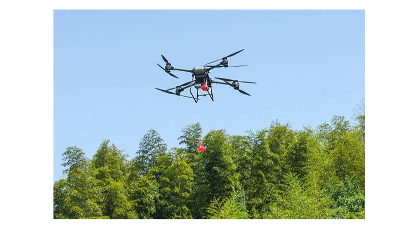
· Airborne platforms: Drones, aircraft, and their applications in environmental monitoring.
· Types of sensors: Multispectral, hyperspectral, synthetic aperture radar (SAR), LiDAR.
· Advantages and limitations of different platforms and sensors for specific environmental tasks.
· Data sources and archives: Accessing publicly available remote sensing data.
· Practical session: Exploring satellite data archives and downloading imagery for a selected area.
· Data acquisition methods: Planning and execution of image acquisition missions.
· Radiometric correction: Atmospheric correction, calibration to reflectance.
· Geometric correction: Image registration, orthorectification, and georeferencing.
· Image enhancement techniques: Contrast stretching, filtering, and band combinations.
· Data formats and file management for remote sensing data.
· Practical session: Performing radiometric and geometric corrections on sample satellite imagery.
· Visual image interpretation: Elements of image interpretation (tone, texture, pattern, shape, size, association).
· Principles of digital image classification: Supervised vs. unsupervised classification.
· Common classification algorithms: Maximum Likelihood, K-means, Support Vector Machine (SVM).
· Accuracy assessment of classification results: Confusion matrices, producer's and user's accuracy, Kappa coefficient.
· Introduction to image segmentation and object-based image analysis (OBIA).
· Practical session: Performing supervised and unsupervised classification on a dataset and assessing accuracy.
· Introduction to GIS: Components, functions, and data models (vector and raster).
· Spatial data acquisition and management in GIS: Digitizing, data conversion, database design.
· Spatial analysis techniques in GIS: Overlay analysis, buffering, proximity analysis.
· Integration of remote sensing and GIS for comprehensive environmental analysis.
· Cartography and map production: Designing effective environmental maps.
· Practical session: Importing classified remote sensing data into GIS and performing basic spatial analysis.
· Concepts of land cover and land use: Definitions and classifications.
· Methods for change detection: Image differencing, post-classification comparison, change vector analysis.
· Monitoring deforestation and forest degradation using remote sensing.
· Mapping urban expansion and its environmental impacts.
· Assessing agricultural land changes and crop monitoring.
· Practical session: Performing land cover change detection analysis using multi-temporal satellite imagery.
· Monitoring water bodies: Delineation of lakes, rivers, and wetlands.
· Assessing water quality parameters: Chlorophyll-a, suspended sediments, turbidity.
· Mapping flood extent and flood risk assessment.
· Monitoring snow and ice cover for water resource estimation.
· Applications in irrigation management and water use efficiency.
· Practical session: Delineating water bodies and analyzing water quality parameters from satellite images.
· Remote sensing for pre-disaster preparedness: Hazard mapping and vulnerability assessment.
· Rapid damage assessment after disasters: Earthquakes, floods, wildfires, volcanic eruptions.
· Monitoring disaster recovery and reconstruction efforts.
· Early warning systems using remote sensing data.
· Post-disaster environmental impact assessment.
· Practical session: Using satellite imagery for rapid damage assessment following a simulated disaster event.
· Hyperspectral remote sensing: Principles and applications in environmental monitoring.
· LiDAR (Light Detection and Ranging) technology for 3D mapping and terrain analysis.
· Synthetic Aperture Radar (SAR) for all-weather monitoring and surface deformation.
· Introduction to machine learning and deep learning in remote sensing.
· Cloud computing platforms for remote sensing data processing (e.g., Google Earth Engine).
· Practical session: Exploring hyperspectral data or SAR data for a specific environmental application.
· Review of course concepts and tools.
· Guided individual or group project work on a chosen environmental monitoring topic.
· Data acquisition, processing, analysis, and interpretation for the project.
· Presentation of project results and discussion.
· Case studies highlighting successful remote sensing applications in environmental monitoring.
· Practical session: Applying all learned techniques to a comprehensive environmental monitoring project from data acquisition to final map/report generation.
Requirements:
· Participants should be reasonably proficient in English.
· Applicants must live up to Armstrong Global Institute admission criteria.
Terms and Conditions
1. Discounts: Organizations sponsoring Four Participants will have the 5th attend Free
2. What is catered for by the Course Fees: Fees cater for all requirements for the training – Learning materials, Lunches, Teas, Snacks and Certification. All participants will additionally cater for their travel and accommodation expenses, visa application, insurance, and other personal expenses.
3. Certificate Awarded: Participants are awarded Certificates of Participation at the end of the training.
4. The program content shown here is for guidance purposes only. Our continuous course improvement process may lead to changes in topics and course structure.
5. Approval of Course: Our Programs are NITA Approved. Participating organizations can therefore claim reimbursement on fees paid in accordance with NITA Rules.
Booking for Training
Simply send an email to the Training Officer on training@armstrongglobalinstitute.com and we will send you a registration form. We advise you to book early to avoid missing a seat to this training.
Or call us on +254720272325 / +254725012095 / +254724452588
Payment Options
We provide 3 payment options, choose one for your convenience, and kindly make payments at least 5 days before the Training start date to reserve your seat:
1. Groups of 5 People and Above – Cheque Payments to: Armstrong Global Training & Development Center Limited should be paid in advance, 5 days to the training.
2. Invoice: We can send a bill directly to you or your company.
3. Deposit directly into Bank Account (Account details provided upon request)
Cancellation Policy
1. Payment for all courses includes a registration fee, which is non-refundable, and equals 15% of the total sum of the course fee.
2. Participants may cancel attendance 14 days or more prior to the training commencement date.
3. No refunds will be made 14 days or less before the training commencement date. However, participants who are unable to attend may opt to attend a similar training course at a later date or send a substitute participant provided the participation criteria have been met.
Tailor Made Courses
This training course can also be customized for your institution upon request for a minimum of 5 participants. You can have it conducted at our Training Centre or at a convenient location. For further inquiries, please contact us on Tel: +254720272325 / +254725012095 / +254724452588 or Email training@armstrongglobalinstitute.com
Accommodation and Airport Transfer
Accommodation and Airport Transfer is arranged upon request and at extra cost. For reservations contact the Training Officer on Email: training@armstrongglobalinstitute.com or on Tel: +254720272325 / +254725012095 / +254724452588
| Course Dates | Venue | Fees | Enroll |
|---|---|---|---|
| Mar 16 - Mar 20 2026 | Kisumu | $1,500 |
|
Armstrong Global Institute
Typically replies in minutes